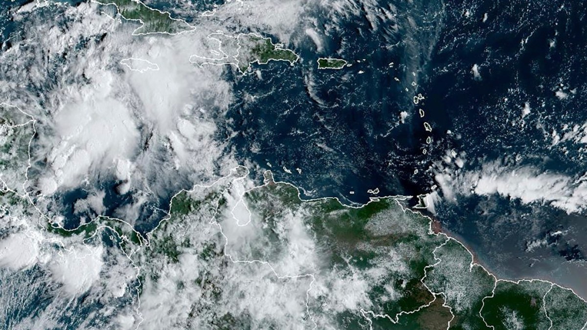
A system of storms in the Caribbean is forecast to develop into Hurricane Helene by the middle of this week.
Parts of Cuba and Mexico are under a hurricane watch as a storm system is expected to strengthen into a major hurricane in the next few days as it moves north towards the southern coast of the United States, weather forecasters have said.
The system of showers and thunderstorms is expected to develop into Hurricane Helene by midweek as it approaches the Gulf Coast of northern Florida in the US, according to the US National Hurricane Center (NHC).
“It could be a major hurricane when it reaches the northeastern Gulf Coast on Thursday,” the NHC said, predicting maximum sustained winds of 177km/h (110mph).
That would classify Helene as bordering on Category 3 on the Saffir-Simpson Hurricane Wind Scale, which uses a rising 1-5 rating based on a hurricane’s sustained wind speed.
11am EDT Key Messages on Potential Tropical Cyclone #Nine: #Hurricane Watches and Tropical Storm Warnings issued for portions of western Cuba and the northeastern #Yucatan Peninsula of #Mexico. Forecast to become a hurricane by Wednesday morning. pic.twitter.com/ZKVTx5NJv9
— National Hurricane Center (@NHC_Atlantic) September 23, 2024
The warm waters of the Gulf of Mexico are likely to help the storm strengthen significantly over the next three days. “It looks likely to track over a warm eddy in the eastern Gulf of Mexico – some bonus rocket fuel for the storm,” Phil Klotzbach, an atmospheric science researcher at Colorado State University, told Al Jazeera.
The cluster of storms was located about 205 kilometres (127 miles) south-southwest of Grand Cayman on Monday. It had maximum sustained winds of 45km/h (30 mph) as it moved north at 9km/h (6 mph).
A hurricane watch was in effect for the province of Pinar del Rio in eastern Cuba and part of the Yucatan Peninsula of southeastern Mexico.
Heavy rainfall is forecast for western Cuba, the Cayman Islands and eastern Mexico, and the southeastern US starting on Wednesday, threatening flash and river flooding, according to the NHC.
Meanwhile, up to 1.2 metres (4 feet) of storm surge is forecast for parts of Cuba and Mexico.
Helene would be the eighth named storm of the current Atlantic hurricane season, which runs from June 1 to November 30, and the fourth to make landfall in the US. Hurricane Francine struck the Gulf Coast of Louisiana as a Category 2 storm barely two weeks ago.
Since 2000, only three other years besides 2024 have had four or more storms make landfall in the continental US.
This year’s hurricane season coincides with an insurance crisis for homeowners in some US states hit by rising fees and reluctance from private insurers to provide coverage in coastal areas.
The US National Oceanic and Atmospheric Administration predicted an above-average Atlantic hurricane season this year because of record-warm ocean temperatures. It forecast 17 to 25 named storms, with four to seven major hurricanes of Category 3 or higher.
But the season is off to a slow start, leaving forecasters searching for factors that may have impeded the formation of major storms as they cross the Atlantic Ocean “hurricane corridor”.


![Tyson Foods Plant [Photo: Food Manufacturing]](https://southarkansassun.com/wp-content/uploads/2023/08/iStock_1185520857__1_.5e441daa51cca-600x337.jpg)


![Silverado Senior Living Management Inc. [Photo: Los Angeles Times]](https://southarkansassun.com/wp-content/uploads/2023/10/download-6-4-600x337.jpg)

![China's Wuhan Institute of Virology [Photo: Nature]](https://southarkansassun.com/wp-content/uploads/2023/09/d41586-021-01529-3_19239608-600x337.jpg)


