


![Tyson Foods Plant [Photo: Food Manufacturing]](https://southarkansassun.com/wp-content/uploads/2023/08/iStock_1185520857__1_.5e441daa51cca-600x337.jpg)


![Silverado Senior Living Management Inc. [Photo: Los Angeles Times]](https://southarkansassun.com/wp-content/uploads/2023/10/download-6-4-600x337.jpg)

![China's Wuhan Institute of Virology [Photo: Nature]](https://southarkansassun.com/wp-content/uploads/2023/09/d41586-021-01529-3_19239608-600x337.jpg)


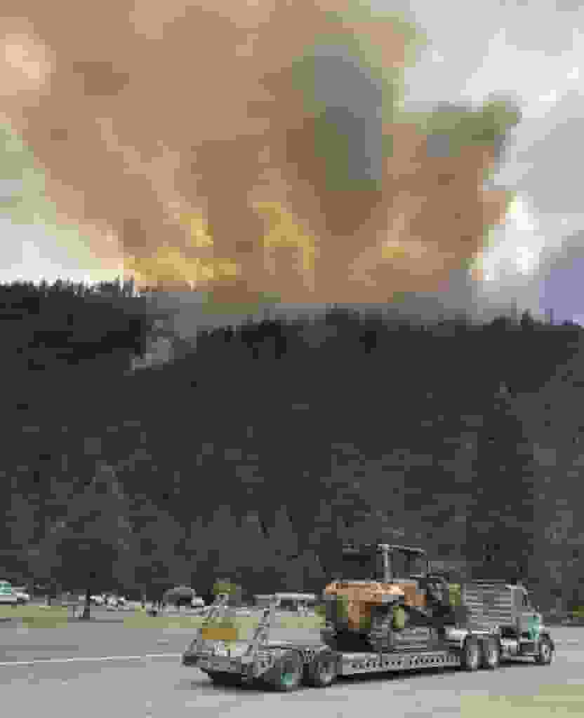
Wednesday after strong winds from a rainstorm pushed a lightning-sparked wildfire rushing over national forest lands, authorities issued evacuation orders for rural regions close to California’s border with Oregon.

Wednesday after strong winds from a rainstorm pushed a lightning-sparked wildfire rushing over national forest lands, authorities issued evacuation orders for rural regions close to California’s border with Oregon. (Photo: Yahoo)
Remaining 10 fires are thought to have burned more than 1,500 acres
In an article posted by USA Today, at least 20 fires, most of them small, broke out in the Klamath National Forest during thunderstorms that produced lightning and downdrafts that fanned the flames through vegetation and rural areas, including the Head Fire in Siskiyou County.
There were 13 fires in the Smith River Complex in Del Norte County, according to a Facebook post from the U.S. Forest Service on Wednesday night, three of which were completely out. According to the article, the remaining 10 fires are thought to have burned more than 1,500 acres.
The U.S. Transportation Department shut down U.S. On Wednesday, Route 199 connected Pioneer Road in the vicinity of Gasquet with the border with Oregon.
READ ALSO: Review On Maui Fire: Emergency Sirens Weren’t Turned On Before The Fatal Blaze
Visitors to the Rogue Valley to use U.S. State Route 42S from Highway 101
There is no alternate route, and there is no estimated time for when the roadway will be repaired, according to TripCheck from the Oregon Department of Transportation. By using Caltrans Quickmap, users may keep track of the closure’s progress.
It is advised that visitors to the Rogue Valley use U.S. State Route 42S from Highway 101, the U.S. The Forest Service stated in a statement on Wednesday night.
According to the Forest Service, alternative routes are not advised because of the dangers and escalating fire activity. Roads owned by the Forest Service and the Bureau of Land Management shouldn’t be used as a detour, article from Vancouver Is Awesome.
