Country Herald is a community news platform for Kankakee, Iroquois, and Will County. Covering breaking local news, sports, lifestyle and events.
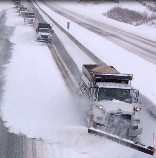
Pittsburgh, PA – Western Pennsylvania residents should prepare for hazardous conditions as a winter storm moves into the area Monday evening. Heavy snow, sleet, and a light ice glaze are expected, making travel dangerous.
According to the National Weather Service (NWS), a Winter Storm Warning is in effect from 7 p.m. Sunday to 7 p.m. Monday. Areas including Greene County, Ligonier, and Donegal may see snow accumulations between 5 and 8 inches. Ice glazing on bridges and overpasses will create especially slick conditions for Monday’s morning and evening commutes.
Drivers are urged to avoid unnecessary travel. If travel is essential, use extreme caution and ensure vehicles are winterized. Officials recommend leaving early to account for delays and reducing speeds to accommodate low visibility and icy surfaces.
The storm is expected to move across east-central Ohio, southwest Pennsylvania, and northern West Virginia, impacting major roadways like I-79 and the Pennsylvania Turnpike. Gusty winds could further reduce visibility as snow drifts occur.
After the storm tapers off Monday evening, conditions will remain cold with lows dipping into the 20s. Tuesday and Wednesday will bring partly cloudy skies, but temperatures will stay near freezing, prolonging icy conditions.
Stay updated on weather developments through local broadcasts, the NWS Pittsburgh Facebook page, or by following @NWSPittsburgh on Twitter.
Be sure to follow us on Instagram & like us on Facebook to stay up-to-date on more relevant news stories and SUPPORT LOCAL INDEPENDENT NEWS!
The post Western Pennsylvania Braces for Ice Glaze on Roadways Monday Evening: Winter Storm Warning Issued appeared first on Country Herald.




![Tyson Foods Plant [Photo: Food Manufacturing]](https://southarkansassun.com/wp-content/uploads/2023/08/iStock_1185520857__1_.5e441daa51cca-600x337.jpg)





![Silverado Senior Living Management Inc. [Photo: Los Angeles Times]](https://southarkansassun.com/wp-content/uploads/2023/10/download-6-4-600x337.jpg)

![China's Wuhan Institute of Virology [Photo: Nature]](https://southarkansassun.com/wp-content/uploads/2023/09/d41586-021-01529-3_19239608-600x337.jpg)
