Rain and storms early today ahead of severe risk Saturday
Heavy rain and a few thunderstorms are passing through the region this morning before gradually clearing out later this afternoon. Overnight, we can expect a few light showers in anticipation of the next system that will move through on Saturday.
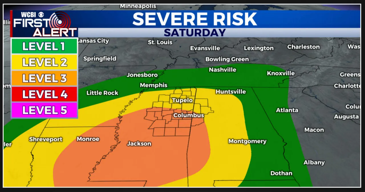
It is important to note that some of the storms on Saturday could potentially be on the stronger side, which is why a Level 3 ENHANCED risk for severe weather has been identified for that day.
Today, we can expect a stormy start to our Friday as a front slowly makes its way through NE Mississippi. The area will experience widespread heavy rainfall, which will continue through mid-morning. However, as we head towards noon, the rain and storms will gradually start to clear out.
High temperatures for today are expected to reach the mid-60s, and the rain will completely clear out by the evening hours. We can expect heavy cloud coverage throughout the day, with a chance of a few light showers overnight. Despite the rain, temperatures will remain mild, with lows only reaching the mid-50s tonight.
Tomorrow, we are expecting another system to move in, bringing the potential for severe weather and stronger storms. The Storm Prediction Center (SPC) has placed us under a Level 3 ENHANCED risk for severe weather on Saturday. Storms are expected to start around noon and continue into the evening.
The primary concerns with this system are gusty winds and hail, although there is also a possibility of tornadoes. Our team is closely monitoring this system for any changes or developments.
This weekend, we can expect the development of storms on Saturday around noon, which will continue into the evening hours. There is a potential for severe weather during this time.
However, the rain and storms are expected to clear out of the area by midnight, with only a few lingering showers possible early Sunday.


![Tyson Foods Plant [Photo: Food Manufacturing]](https://southarkansassun.com/wp-content/uploads/2023/08/iStock_1185520857__1_.5e441daa51cca-600x337.jpg)




![Silverado Senior Living Management Inc. [Photo: Los Angeles Times]](https://southarkansassun.com/wp-content/uploads/2023/10/download-6-4-600x337.jpg)

![China's Wuhan Institute of Virology [Photo: Nature]](https://southarkansassun.com/wp-content/uploads/2023/09/d41586-021-01529-3_19239608-600x337.jpg)


