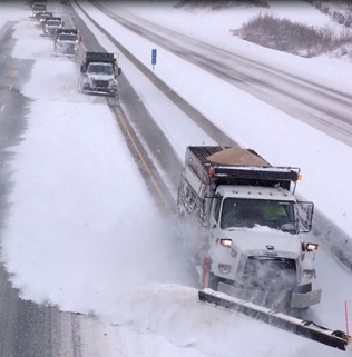
Winter Storm Watches have been issued for areas spanning from Northeast Ohio to NW Pennsylvania, Southwestern NY, and North Central NY for the later part of Wednesday through Thursday night. It is highly probable that lake effect snow warnings will be issued once again for these regions. Another powerful storm system is currently advancing through Southern Canada, which will trigger another round of significant lake effect snowfall from Northeastern Ohio to NW PA, Southwestern NY, and North Central NY. Although this system is stronger than the previous one, it will not remain stationary in Eastern Canada. Instead, it will progress along its path, resulting in reduced snowfall amounts this time. However, it is important to note that another couple of feet of snow is expected in the Lake Effect areas, potentially bringing the total snowfall to nearly 100 inches over the span of seven days in certain locations!
A weather front is expected to move through Wednesday night into Thursday morning, bringing rain and snow showers near the coast and snow inland. The temperatures will be borderline during this time. Based on the current forecast, it is anticipated that areas inland to the north, northwest, or northeast of the major cities (NYC & Philadelphia) may receive a dusting to an inch of snow, primarily on colder surfaces. Areas north of Route 84 in NY state and Connecticut could see 2 to 3 inches of accumulation. Larger snowfall amounts are expected north of I90, as well as in Central and Northern New England.
The upcoming concern is that the coldest air of this ongoing cold spell will follow behind this front from Thursday night until Saturday. As the front passes through, winds will pick up and become strong and gusty, continuing into Friday night. On Thursday, temperatures will range in the upper 30s and lower 40s, but Friday will bring a significant drop in temperatures. Most areas will only reach the low to middle 30s, with slightly higher temperatures in the southern regions and slightly lower temperatures in the northern regions.
The cold air is expected to diminish over the weekend, bringing an end to the lake effect snows. As we move into next week, the weather pattern will become more relaxed with a shift towards a westerly upper flow across the US.


![Tyson Foods Plant [Photo: Food Manufacturing]](https://southarkansassun.com/wp-content/uploads/2023/08/iStock_1185520857__1_.5e441daa51cca-600x337.jpg)





![Silverado Senior Living Management Inc. [Photo: Los Angeles Times]](https://southarkansassun.com/wp-content/uploads/2023/10/download-6-4-600x337.jpg)

![China's Wuhan Institute of Virology [Photo: Nature]](https://southarkansassun.com/wp-content/uploads/2023/09/d41586-021-01529-3_19239608-600x337.jpg)

