


![Tyson Foods Plant [Photo: Food Manufacturing]](https://southarkansassun.com/wp-content/uploads/2023/08/iStock_1185520857__1_.5e441daa51cca-600x337.jpg)


![Silverado Senior Living Management Inc. [Photo: Los Angeles Times]](https://southarkansassun.com/wp-content/uploads/2023/10/download-6-4-600x337.jpg)

![China's Wuhan Institute of Virology [Photo: Nature]](https://southarkansassun.com/wp-content/uploads/2023/09/d41586-021-01529-3_19239608-600x337.jpg)


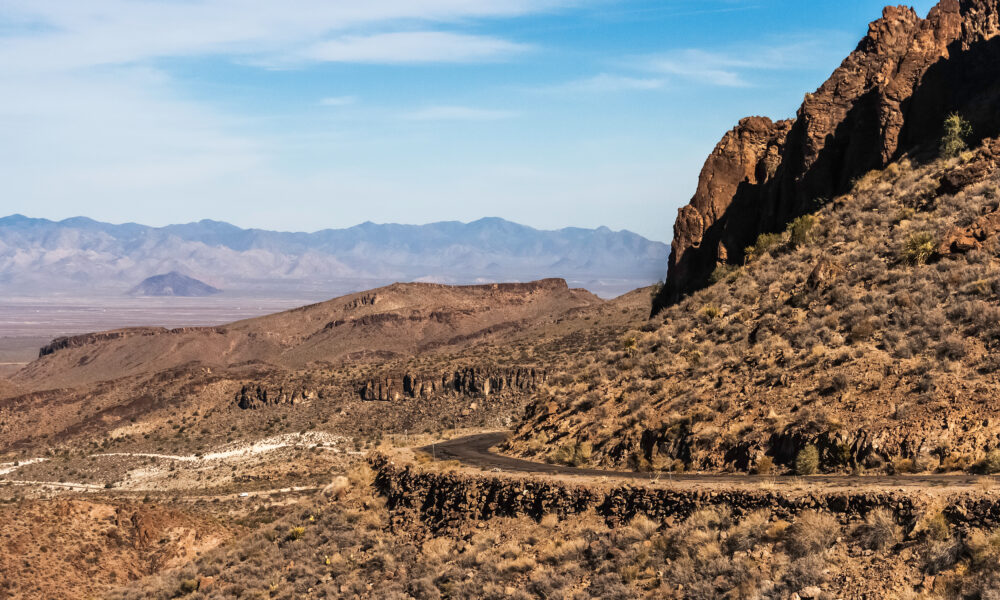

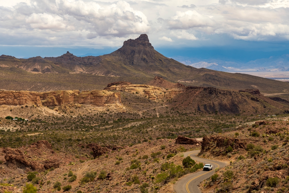
Sitgreaves Pass
Sitgreaves Pass cuts through Arizona’s Black Mountains at 3,550 feet above sea level. The mountain pass became famous in the 1920s when early cars struggled to drive through it.
Captain Lorenzo Sitgreaves gave his name to the pass after surveying the area in 1851. The road winds through sharp turns and steep hills that were too much for old cars to handle, forcing many to drive backwards up the slopes.

How Cars Drove Backwards to Climb the Pass
In the 1920s and early 1930s, drivers found a clever way to get up Sitgreaves Pass. They would drive their cars backwards because the reverse gear was stronger than first gear, with a 4:1 ratio compared to 3:1.
Wooden signs at both ends warned drivers they might need to back up the hill. These signs stayed up until the late 1930s, when cars finally became strong enough to handle the climb. Some locals also made money by helping stuck drivers turn their cars around

Building the Pass Through Rocky Mountains
Workers began building Sitgreaves Pass in 1921, facing huge challenges along the way. They had to blast through rock with dynamite and hand tools, removing 8,000 cubic yards of stone.
The workers dealt with desert heat up to 120°F and limited water that mules had to carry in. They also had to watch out for rattlesnakes while carrying materials up steep slopes since wagons couldn’t reach many areas.
The first road was only 16 feet wide, letting one car pass at a time, with a few wider spots carved into the rock for passing. Sadly, seventeen workers died while building the pass.
How the Pass Helped Train World War II Soldiers
The U.S. Army chose Sitgreaves Pass to train soldiers during World War II. The steep road helped prepare truck drivers for mountain driving in Europe.
Soldiers learned to drive heavy 2½-ton military trucks through sharp turns and steep slopes. The pass was perfect for training because it rose 3,586 feet over miles.

The Pass’s Exceptional Steepness
The steepest part of Sitgreaves Pass rises at a sharp 10.2% grade for 0.7 miles. This steep section sits near the top, where the road curves around a rock formation called Devil’s Elbow.
Today’s highways usually don’t go above a 6% grade, which shows how challenging this old road was. When you drive the pass, you climb 980 feet in just 1.8 miles.

The Volcanic History of the Pass
The rocks around Sitgreaves Pass were shaped by volcanoes 15 million years ago. Strong eruptions laid down black basalt rock over older granite, creating the Black Mountains.
Over time, erosion has exposed different minerals in the mountains. Gold veins found in the area are worth about millions of dollars.

Desert Bighorn Sheep Living Near the Pass
About 150 desert bighorn sheep live in the rocky cliffs along Sitgreaves Pass. These sure-footed animals are often seen on the slopes during early morning and late afternoon.
The high, rocky landscape keeps the sheep safe from mountain lions and provides plants for food. These sheep have lived in the area since at least the 1850s.

How the Pass Changed Car Design
The steep climb at Sitgreaves Pass led car makers to improve their designs in the late 1920s. Companies like Chrysler and General Motors created better fuel pumps because cars struggled to get fuel while climbing.
These new pumps kept fuel flowing steadily no matter how steep the road was. Car makers used the pass to test and improve their vehicles.

Safety Improvements Made to the Pass
Road crews upgraded Sitgreaves Pass in 1952 to make it safer. They added 2.8 miles of strong guardrails that could handle temperatures from 20°F to 120°F.
They also used special road materials that wouldn’t buckle in summer heat. Every 200 feet, they put in drainage pipes to prevent flood damage.

Unique Weather Patterns at the Pass
Sitgreaves Pass creates its own weather because of its height. The temperature often differs by 15 degrees between the bottom (1,900 feet) and top (3,550 feet). These temperature changes cause fog and strong winds up to 45 mph.
In summer, hot air rising from the valley meets cool air at the top, forming uniquely shaped clouds.

Native American Trails Through the Pass
Native Americans used Sitgreaves Pass as a trade route long before Route 66 existed. Archaeologists have found pottery and tools from 900 AD, showing that tribes traveled through this gap in the mountains.
Rock carvings near the pass show bighorn sheep, spirals, and human figures. The old tribal path helped road builders decide where to put the modern road.

Star Viewing from the Mountain Pass
Sitgreaves Pass offers great views of the night sky, letting people see miles away on clear nights. The high elevation and dark skies make it perfect for spotting stars and planets.
Star watchers often gather at a wide spot near the top of the pass. During new moons, you can see thousands of stars and get a clear view of the Milky Way.

How the Pass Created Local Business Growth
From 1926 to 1952, towns near Sitgreaves Pass grew because travelers needed lots of help. A lot of repair shops and gas stations opened to serve the cars that go through this route.
These businesses were crucial for travelers making the difficult journey. Today, the pass draws tourists instead of stranded drivers.

The Pass as a Photography Landmark
Photographers have captured Sitgreaves Pass countless times, making it a star of Route 66 books and films. The winding road and desert views create striking pictures.
Photos of the pass taken years before are still kept in the Arizona State Archives. These pictures show how the road has changed and document all types of vehicles that have climbed the pass.
The post Route 66 Drivers Have Been White-Knuckling This 3,550-Ft Mountain Pass Since the 1920s appeared first on When In Your State.