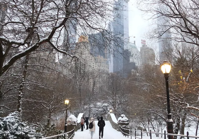
After experiencing a warmer-than-usual winter last year, New York City is bracing for another shift in weather patterns. Meteorologists and the NOAA’s U.S. Winter Outlook indicate that an evolving La Niña will likely impact this winter season.
Winter Solstice: The Official Start of Winter 2024
Winter officially begins in the Northern Hemisphere on December 21, coinciding with the winter solstice. This date marks the shortest day of the year and the longest night, signaling the onset of winter.
Understanding La Niña’s Impact on Winter Weather
La Niña occurs when the surface temperatures of the Pacific Ocean are cooler than normal, influencing global weather patterns. Typically, the southern U.S. experiences drier and warmer conditions, while the Great Lakes and parts of the Northeast see cooler and wetter weather.
According to Nick Gregory from FOX 5 NY, “A La Niña pattern can lead to above-average temperatures for NYC and at or just above-average snowfall.” He notes that previous La Niña winters have been associated with strong nor’easters and blizzards.
However, the effects of this year’s La Niña on the Tri-State area remain uncertain, as it is expected to be weak and may dissipate by early spring. Gregory explains, “The upcoming La Niña is forecasted to be a rather weak one, which means it may produce the characteristic effects of a more moderate La Niña.”
Will New York City Experience a Nor’easter This Winter?
The La Niña pattern suggests that New York City may experience normal to slightly below-average temperatures this winter. Gregory asserts, “NYC will always have a nor’easter in the winter.” The key concern is the temperature during these storms. A weak La Niña could create a battleground between rain and snow across New York City and its nearby suburbs.
Snowfall Predictions for the NYC Area
Gregory anticipates that New York City might receive around 20 inches of snow this winter, which is lower than the typical 28 inches. He states, “This winter is likely to be warmer than usual, and there will be more snow than last year—between 18 and 23 inches.” However, he notes that this is still less than the average winter snowfall for the city.
In contrast, the lower Hudson Valley could see slightly higher totals, with predictions of 20 to 25 inches. Further north is expected to have more significant snowfall, while coastal areas may experience a mix of rain and snow throughout the season.
Historically, the first measurable snowfall (at least an inch) in the NYC area typically occurs around December 13. The earliest recorded measurable snow happened on October 29, 2011, when 2.9 inches fell just before Halloween.
Regional and National Winter Outlooks
Also read: IRS Unveils 2025 Tax Brackets and COLA: What New York Residents Need to Know
NOAA’s Winter Forecast
NOAA’s winter outlook suggests that the northern U.S. will likely be wetter than usual, particularly in the Great Lakes region, which will face colder temperatures and increased rainfall. Conversely, the southern U.S. is expected to have a warmer and drier winter.
For the Tri-State area, these trends may manifest along the borders, as storm systems often shift north when La Niña is weak. This could lead to a continual battle between rain and snow for New York City throughout the winter.
The Old Farmer’s Almanac Predictions
The Old Farmer’s Almanac predicts a “gentler-than-normal season” in the central Northeast. For the Interstate 95 corridor, which includes the Tri-State area, snowfall is expected to be below average in the northern regions but above average in the southern areas. The coldest temperatures are anticipated in early and late January and late February.
Farmers’ Almanac Insights
The Farmers’ Almanac warns to “Get ready for a Wet Winter Whirlwind!” They forecast a winter filled with quickly moving storms bringing both rain and snow. Their predictions indicate a busy storm track affecting the eastern half of the country regularly.
According to the almanac, the Northeast will likely experience increased storm activity, more snowfall than usual, and temperatures near or above average. The mountains and interior regions are expected to receive the most snow, while coastal areas may see sleet and rain, especially near and along I-95. They have flagged the last week of January for potential storm activity, signaling a busy period ahead.


![Tyson Foods Plant [Photo: Food Manufacturing]](https://southarkansassun.com/wp-content/uploads/2023/08/iStock_1185520857__1_.5e441daa51cca-600x337.jpg)



![Silverado Senior Living Management Inc. [Photo: Los Angeles Times]](https://southarkansassun.com/wp-content/uploads/2023/10/download-6-4-600x337.jpg)

![China's Wuhan Institute of Virology [Photo: Nature]](https://southarkansassun.com/wp-content/uploads/2023/09/d41586-021-01529-3_19239608-600x337.jpg)


